
In ancient footsteps
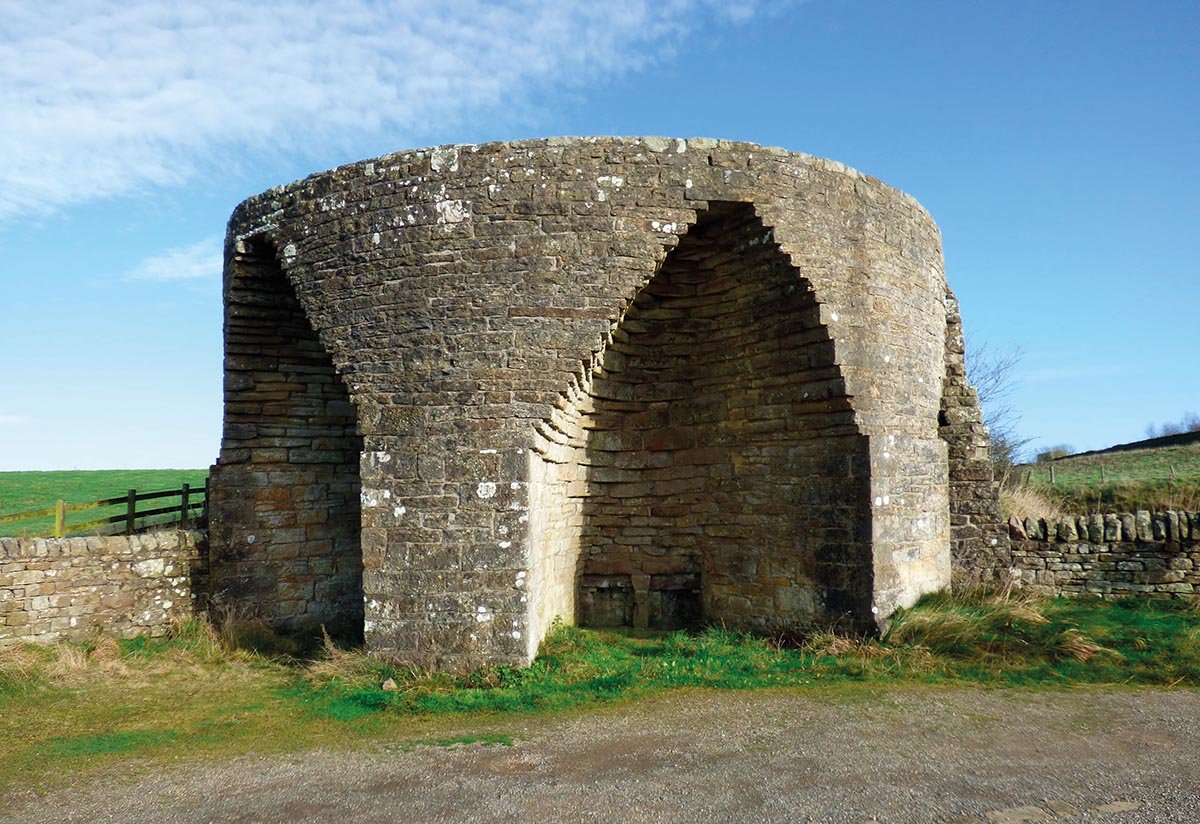
Crindledykes limekiln (Photos by Anthony Toole)
First published in edition 206 of The Northumbrian, June/July 2025
Anthony Toole explores a route from Crindledykes to Muckle Moss to discover a panoramic view of Hadrian’s footsteps, the remains of an Iron Age settlement and a variety of beautiful flora and fauna
My first steps on this walk led me up a brisk ascent to reach the Barcombe Hill trig point just 10 minutes after leaving the road. Despite the low altitude, the view encompassed a 360-degree panorama. To the east it faded into a coastal haze with Grindon Lough prominent in the foreground. To the south and west it reached the Pennines, while across the north stretched the escarpment marked by the route of Hadrian’s Wall. On the near rise to the north-east were the grassed-over remains of an Iron Age settlement, and in a direct line from that lay Housesteads Fort.
A short walk brought me to the Iron Age settlement, among the humps and hollows of which, though indistinguishable from them, were the foundations of a Roman signal station. From the edge, I looked down onto my starting point a short distance from Crindledykes lime kiln. This is one of around 300 limekilns in the county, most active during the 19th century and phased out by the early 20th. Like others, Crindledykes crumbled into disrepair, but was restored in 1989 and is now a Grade II listed building.
The kiln was fed with limestone from nearby quarries. This was heated for perhaps a couple of days, when the calcium carbonate decomposed into quicklime (calcium oxide) with the elimination of carbon dioxide. Water was poured onto the quicklime in a vigorous reaction to convert it into slaked lime (calcium hydroxide); an alkaline compound which was spread onto the fields to neutralise the soil acids. This could also be mixed with clay and sand to form mortar for use in construction. Of further interest is the fact that a solution of slaked lime is known as lime water, which, as you may remember from school science lessons, turns cloudy when carbon dioxide is bubbled through it, the cloudiness due to the formation of tiny solid particles of calcium carbonate, thus bringing this chemical aspect of limestone full circle.
I retraced my steps past the trig point and continued to a tall, thin sandstone pillar that marks the west end of the ridge. Though its origin is unknown, it is referred to as the Long Stone, and it commands an even better view than those from either the trig point or the settlement. The hillside drops away sharply to Vindolanda lying map-like in the fields below, looking almost close enough to be reached by a flung stone.
I followed the wall back to a gate which opened onto a two-wheel track running south through bracken, soft rush, and moss-covered rocks. Occasional patches of dried mud bore the fossilised prints of vehicle tyres and sheep’s hooves. A meadow pipit hopped across the track a short distance ahead, pausing for a few seconds as I stood still before flying off to the east. Halfway down the slope, a less well-defined footpath broke away to the left and to a stile over a stone wall marking the limit of the valley fields. On the final descent into Thorngrafton village I passed the skeleton of a dead tree. Though the wood appeared desiccated, it supported a thick growth of almost leafy lichens. From there, I glanced back to the skyline, where the trig point and the stone pillar, though shrunk by distance, remained clearly visible.
The road east out of Thorngrafton was narrow but quiet, with only a Post Office van and a solitary motorcyclist passing me. After half-a-mile the road turned abruptly north and led after a similar distance to the corner of Muckle Moss, a National Nature Reserve and Site of Special Scientific Interest. I entered the reserve on a footpath that crossed gently sloping ground through soft rush and mole hills to a gate and adjoining stile, then up more steeply through bracken and heather to the first of the sandstone ridges that enclosed the main area of the moss.
The depression that lies between this and the second ridge to the north was once occupied by a shallow lake formed from the meltwater of an Ice Age glacier. Over the centuries this filled to a depth of up to 6 metres with the peat-forming vegetation of sphagnum mosses and cotton grass to create what is now a basin mire. The gently sloping sandstone bedrock allows the peat to slide, occasionally opening small, temporary pools that become home to dragonflies and damselflies. These pools are seen if you walk along the dry ridges. Plants that thrive in the acid soil include bog asphodel and the insectivorous sundew, while heather clings to the drier sandstone ridges. Birds such as curlew, snipe and wheatear nest here, while tawny owls frequent the surrounding woodlands, from which roe deer often encroach onto the moss.
After a short, rocky descent, I crossed the main depression to the second ridge, beyond which lay the Stanegate, which traces the line of the Roman road parallel to Hadrian’s Wall. I followed the Stanegate west for a short distance, then detoured to Crindledykes Farm. Just south of the farm, I crossed the field on a permissive path to the eponymous quarry and my second nature reserve of the day, this administered by Northumberland Wildlife Trust. This is where much of the limestone that fed the nearby limekiln was obtained.
The quarry is shallow, but the strata exposed on the faces were magnificently folded by forces that resulted from great earth movements many millennia ago. In complete contrast to the acidic soils of Muckle Moss, those of East Crindledykes Quarry are alkaline. As such, they support a totally different array of flora, which gives it a lush and much more colourful ambience. In spring and summer, orchids, cowslips, plantains and small scabious grow amid carpets of wild thyme and bird’s foot trefoil, which all attract large numbers of butterflies, moths and other pollinating insects.
I returned to the Stanegate, which after a few minutes brought me back to my starting point at Crindledykes limekiln.