
Six of the best
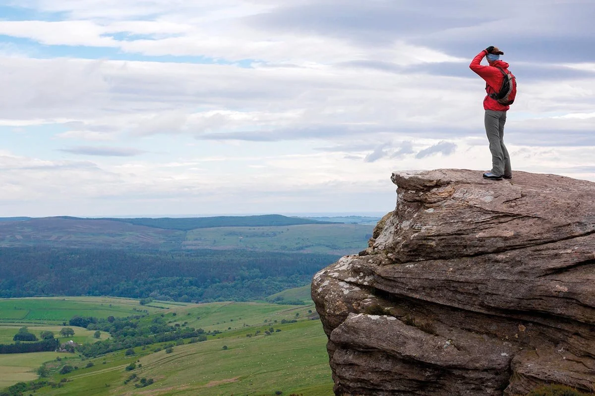
Simonside Ridge Walk (photo: Duncan Andison)
First published in edition 205 of The Northumbrian, Apr/May 2025
At last, we are waking from our winter slumber. Time to go outdoors, with six spring walks over hillside, country and coast selected by David Steel
In the hills, through the countryside along the coast, Northumberland offers much for a walk or stroll. The problem in writing this article is where to start because there are so many options. Any good walk begins with planning and I’ve chosen the ones here to offer a variety of locations and lengths, attempting to bring the unique essence of walking in Northumberland to the page.
Taking in the view in the Simonside Hills
The Simonside Hills offer a range of walking routes, but one trail stands out. Starting from a car park located a mile up the road from the main entrance, the walk begins on the historic St Oswald’s Way. Along the route, informative boards provide fascinating insights into the area’s geology and wildlife, including grouse, chiffchaffs, curlews, wild goats, and deer.
The path, which is paved with large stone slabs, gently ascends, rewarding walkers with ever-changing 360° views. Soon, the path splits, and the right-hand route leads along the Simonside Ridge Walk. This section is the steepest, but the effort is well worth it, as the cairn offers stunning views of the Coquet Valley.
Continuing, the path levels out, leading to Dove Crag. On clear days, the view stretches from the Northumberland coast to the Cheviots, making this a popular stop for walkers. The route proceeds across the plateau to reach Old Stell Crag, where a small rocky scramble through a gully adds a bit of adventure.
At Simonside itself, the path leads to the summit at 430 meters. The views are breathtaking from here, with the Cheviots to the north, the coastline to the east, and the Tyne Valley stretching south.
For the return, you can either retrace your steps or descend via a steeper path, passing through the woods and following well-marked routes back to the start, ensuring a satisfying finish to an unforgettable hike.
Distance: 4.5 miles
Terrain: Paving slabs, some boggy ground
Ability: Some experience of hill walking would be an advantage
Dogs: On a lead at some points
Start/end point: grid ref 55016’59.3”N 1055’08.7”
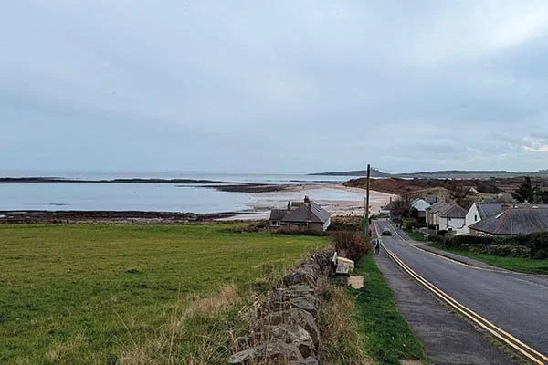
Low Newton
Low Newton to Craster
No guide to Northumberland walks would be complete without a route along its magnificent coastline, officially designated as an Area of Outstanding Natural Beauty (AONB). One of the most spectacular walks begins at Low Newton, taking in sea views, historic ruins, and a charming fishing village.
Starting at Low Newton, the route descends toward Newton Beach, with the iconic silhouette of Dunstanburgh Castle on the horizon. Walking along the shore, the crisp sea air and the boats anchored in the bay set a peaceful tone. Birdwatchers will enjoy spotting curlews, snipes, and gulls.
Reaching the end of Embleton Bay, a glance back reveals the stunning coastal landscape. The path then leads past the ruins of Dunstanburgh Castle before continuing along rugged fields to Craster, famed for its kippers. This quaint fishing village is the perfect place for a rest stop.
The return journey veers inland, offering expansive coastline views, with Dunstanburgh Castle standing proudly to the north. The path passes through Dunstan Square and Dunstan Steads, winding through dunes and past rustic wooden huts. Nearing the end, walkers encounter Newton Pool Nature Reserve, a haven for birdlife.
Finishing back at Low Newton, there’s no better way to end the walk than by relaxing at the Ship Inn, reflecting on a truly unforgettable Northumberland experience.
Distance: 7 miles
Terrain: Beach and well-defined paths
Dogs: On a lead at some points
Ability: Novice
Start/end: The car park at Newton by the Sea
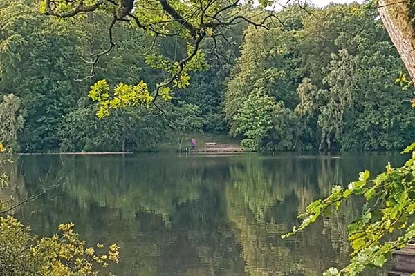
Bolam Lake
Bolam Lake to Shaftoe Crags
A peaceful walk around Bolam Lake is always rewarding. Designed by John Dobson for Rev’d John Beresford in 1816, the lake and surrounding woodlands offer a tranquil setting with abundant wildlife. Roe deer and red squirrels roam the forest, while swans and waterfowl glide across the lake, and woodpeckers, bullfinches, nuthatches and treecreepers sing among the trees. For an extended route, the walk continues west toward Shafto Crags.
Leaving Bolam Lake, follow the road before turning left onto a single-track lane to Sandyford. After passing the farm, a right turn leads along scenic field edges, where the fresh country air enhances the sense of solitude. A marked footpath at West Tofthill Farm guides you north to East Shaftoe Hall, crossing the ancient Devil’s Causeway, a Roman road linking Corbridge to Berwick.
At East Shaftoe Hall, turn left and begin a gentle ascent to Shafto Crags, reaching the 213 metre high trig point. From the summit, enjoy breathtaking 360° views, stretching from the Tyne Valley in the south to the Simonside Hills in the north– a perfect spot to pause and enjoy the view.
The descent heads north past Shaftoe Grange, following the fence to a natural junction. Turning right, the path passes an ancient settlement before reaching Bolam West House. The final stretch follows the road back to Bolam Lake, where a well-earned rest awaits.
Distance: 5 miles
Terrain: Firm underfoot and tracks
Dogs: On a lead at some points
Ability: Novice
Start/end: Bolam Lake west car park
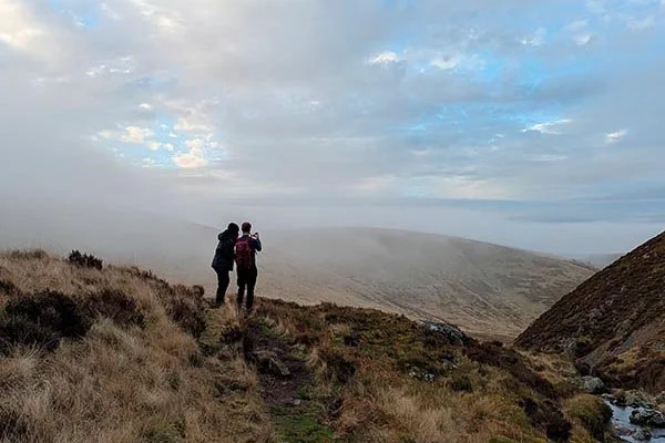
College Valley
College Valley & Three Sisters Waterfall
West of Wooler in the Cheviot Hills, College Valley is a breathtaking destination. Even
the drive through it is worth the trip, and I recommend that along the way you pause at the World War II memorial which commemorates 58 airmen lost in 19 crashes.
At the valley’s head, the walk begins past Mounthooly Bunkhouse, where College Burn flows alongside framed by woodlands. The well-trodden path leads south to reveal ever-changing scenery, so don’t forget to look back, while to the right The Schil (601m) towers along the Pennine Way.
The valley is alive with birdlife, including chiffchaffs, siskins, bullfinches, lapwings, snipe and oystercatchers. You may even spot a peregrine, red kite or kestrel. As the path dips and turns left, the terrain becomes slightly boggy so sturdy footwear is recommended. Soon, the dramatic Hen Hole Valley comes into view.
Following College Burn, pass smaller waterfalls before reaching the stunning Three Sisters Waterfall, where three cascades plunge into a rocky pool. For the adventurous, the challenging route up The Hen Hole awaits another day. Retracing your steps, the magnificent views of College Valley make the return journey feel like a new walk.
Distance: 3 miles
Terrain: Boggy in places
Ability: Novice
Dogs: On a lead at some points
Start/end: Mounthooly Bunkhouse, grid ref 55029’48.2”N 2011’21.5”W
Morpeth
Morpeth town, park & river
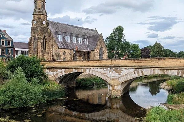
Historic Morpeth, which dates back to 1080, offers a charming blend of history and nature. This walk begins in the town centre near the iconic clock tower and town hall designed by John Vanbrugh in 1714. Instead of crossing the bridge, head up Newgate Street and take a left toward Mitford before turning left again to cross Skinnery Footbridge over the River Wansbeck, which originates from Sweethope Loughs.
Following the tranquil path through Challoner’s Gardens, you’ll walk alongside the river, spotting wading and woodland birds. Passing the stepping stones, the route leads to a bridge with views back to the clock tower. Continue under the bridge, strolling along the tree-lined banks of the Wansbeck into Carlisle Park, home to a children’s playground and bowling greens. Passing Elliott Footbridge, where wooden rowing boats can be hired in summer, the route reaches Ha’ Hill, offering panoramic views of Morpeth and the river.
Following the signed paths, arrive at 11th century Morpeth Castle. The walk then leads past the town’s cenotaph before descending Castle Bank to Morpeth Court, an early 16th-century building. Nearby, the entrance to Carlisle Park features a statue of suffragette Emily Wilding Davison.
Turning right past the Court House, continue along Goose Hill to Bennett’s Walk and Gas House Lane footbridge. The final stretch follows the peaceful riverside path to Oliver’s Mill before returning to Morpeth for well-earned refreshments.
Distance: 3 miles
Terrain: Well-established paths
Dogs: On a lead at some points
Ability: Novice
Start/end: Clock tower in Morpeth
Hindhope Linn (photo: drhfoto)
Hindhope Linn
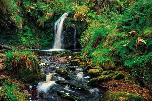
There are many waterfalls in Northumberland, and this is one of the lesser-known ones, but that does not mean it is not spectacular. This short walk starts just off the A68 by Blakehopeburnhaugh, Rochester, after parking up at Blakehopeburnhaugh where there is information regarding the walks in Kielder Forest, wildlife, and the walking trails.
You head over the bridge along the route of the Pennine Way, passing a farm on your right before coming to the trees and a path on your right, which is signed for Hindhope Linn Trail. You now have a pleasant walking trail through the woods where you will be serenaded by the birds such as chaffinches, siskins, warblers and herons in the river. The trail follows the route of Blakehope Burn; there is always a certain tranquillity to walking along a stream or river path.
You come to an estuary which joins Blakehope Burn, which is Hindhope Burn, and on our right, you can start to see the waterfall. As you head up to the falls, you first notice the sound of the falls; it dominates all other sounds at this point; you continue up the side of the Burn to the Dell, which Hindhope Linn Waterfall dominates. You can dip your feet in it if you’re brave.
After spending some time taking in the beauty and tranquillity of the falls, you retrace your steps. When reaching your car, you will feel refreshed and energised, ready once again to tackle the day ahead.
Distance: 3 miles
Terrain: Can be boggy underfoot
Dogs: On a lead at some points
Ability: Novice
Start/end: Blakehopeburnhaugh Car Park 55017’45.0”N 2020’26.3W